Agriculture
Consulting & Services
Environmental and Green Technology
MySTI Certified
STI202501293

Design and Planning of Oil Palm Plantation Replanting Program using Drone with LiDAR Sensor (GEO-REPLANTING)

MySpatial Sdn Bhd

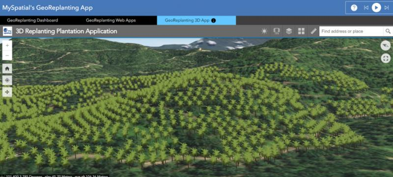
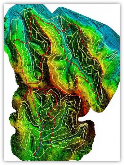
GEO-REPLANTING by MySpatial is a specialized design and planning service tailored for oil palm replanting programs, engineered to boost productivity, optimize land use, and support sustainable plantation management. The service integrates advanced drone-based data acquisition using high-precision LiDAR and RGB sensors to map topography, assess current plantation conditions, and capture critical land features. 
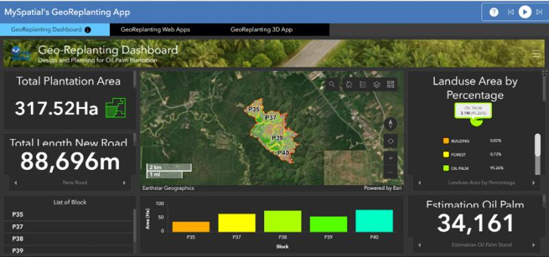
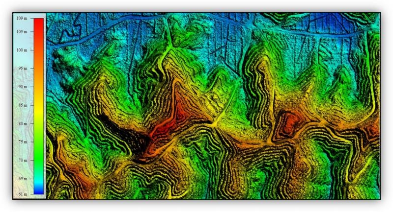
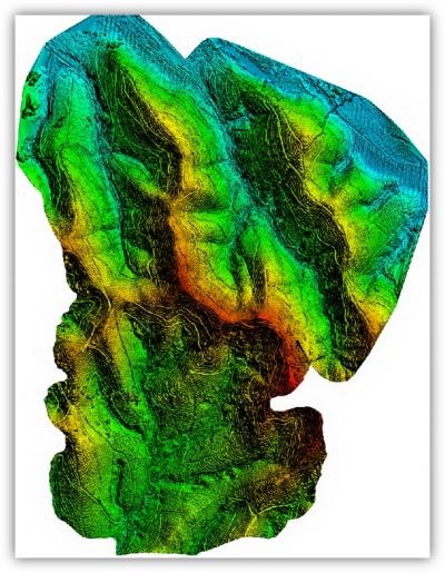
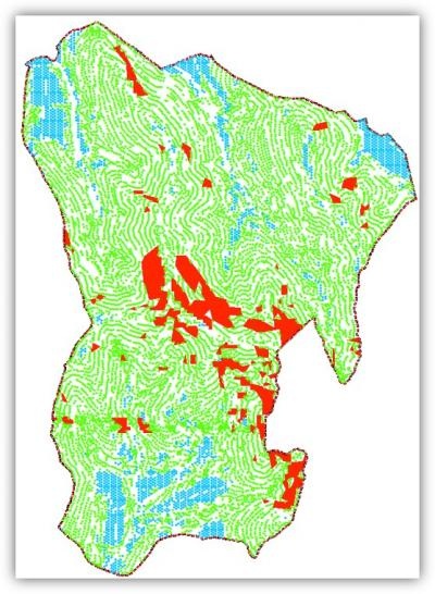
The collected data undergoes advanced geospatial processing, generating Digital Terrain Models (DTM), Digital Elevation Models (DEM), slope classifications, and hydrological flow analyses. These insights form the foundation for precise replanting blueprints, including optimized road alignments, terrace configurations, block divisions, and accurate palm stand layouts—each designed to enhance yield and streamline field operations. Key advantages of GEO-REPLANTING include significant reductions in time and cost compared to conventional survey methods. With precision-driven designs, plantation owners can maximize land productivity and long-term profitability. The service also promotes environmentally responsible practices by enabling erosion control, efficient water flow, and compliance with certification standards such as MSPO and RSPO. Backed by MySpatial’s 15 years of geospatial expertise in the plantation sector, GEO-REPLANTING empowers stakeholders to make data-driven decisions at every stage of the replanting lifecycle. Its high-resolution outputs and clear spatial planning insights support better budgeting, forecasting, and operational planning. The service is ideal for oil palm plantation owners, management firms, and agribusinesses across Malaysia seeking to modernize and optimize their replanting strategies. Notable clients such as RISDA Estate Sdn Bhd, Sarawak Land Consolidation and Rehabilitation Authority (SALCRA) and FELCRA Berhad have already adopted this solution to elevate the efficiency and sustainability of their operations. GEO-REPLANTING positions MySpatial as a forward-thinking partner for plantation transformation—delivering innovative, geospatially informed planning solutions that meet today’s agricultural challenges and sustainability goals.

SSM Registration Number
MySpatial Sdn Bhd
ePerolehan Number
eP-1006I01N8
Indicative Price
MYR 120.00
Company Email Address
dini@myspatial.com.my
No items found.

Recommended Market Segment

Use Cases

Unique Selling Proposition

star

Precision Replanting Blueprint via Advanced Drone & LiDAR Analytics

GEO-REPLANTING delivers unparalleled precision in oil palm replanting by leveraging cutting-edge drone technology integrated with LiDAR and RGB sensors. We generate highly accurate 3D terrain models and detailed geospatial data, forming the basis for meticulous 'blueprint' designs of road networks, terraces, and planting points. This data-driven approach significantly surpasses traditional survey methods in accuracy and detail , enabling optimized land utilization and minimizing costly errors during implementation, thereby ensuring a solid foundation for maximized future yields and efficient plantation management from day one.

star

Holistic Planning for Enhanced Productivity & Environmental Sustainability

Our service provides a holistic, end-to-end replanting solution, encompassing every stage from initial site assessment and data analysis to detailed blueprint design and on-site implementation guidance. We strategically integrate productivity enhancement goals with robust environmental stewardship by designing replanting plans that maximize potential yield while concurrently minimizing soil erosion and optimizing water management. This approach aligns with sustainability certifications like MSPO and RSPO, ensuring efficient resource use, reducing operational risks, and promoting long-term plantation health and ecological balance

star

Significant Cost & Time Savings Through Technology-Driven Efficiency

GEO-REPLANTING offers substantial and demonstrable cost and time efficiencies in the execution of oil palm replanting programs. The rapid and accurate data acquisition capabilities of drone and LiDAR technology, coupled with automated geospatial analysis, drastically reduce the need for extensive traditional fieldwork and time-consuming manual planning efforts. Detailed pre-implementation 3D visualizations and precise calculations for infrastructure (e.g., road length, terrace volume) and planting materials (e.g., palm count estimates) prevent budget overruns and streamline project execution, delivering a faster return on investment for plantation owners.

star

star

star