Automotive
Logistics and Transportation
Security
MySTI Certified
STI202501318

Real-Time Mobile Navigation Map for Military Vehicles (MILINAV)

MySpatial Sdn Bhd

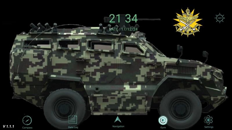
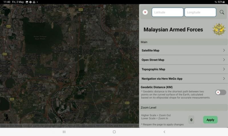
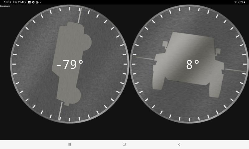
MILINAV is a real-time mobile navigation system engineered specifically for military vehicles of the Malaysian Armed Forces. The solution addresses critical operational gaps not met by commercial navigation tools by providing seamless display and navigation using local topographic maps generated by the Department of Survey and Mapping Malaysia (JUPEM), including L7030, T738, MY701T, and MY711T series. Designed for convoy operations, reconnaissance, and special operations units , MILINAV operates on a ruggedized tablet compliant with US Military Standard MIL-STD-810H, ensuring reliability in harsh environments. The system functions completely offline by utilizing pre-loaded, encrypted map data, making it ideal for missions in network-denied areas. Key features include multi-coordinate system support (including GDM2000 and Grid Reference) , an integrated gyroscope for vehicle roll and pitch monitoring , a tactical compass , and a comprehensive data logger for after-action reviews. By integrating local map data with mission-critical tools, MILINAV significantly enhances situational awareness and operational effectiveness on the battlefield.

SSM Registration Number
MySpatial Sdn Bhd
ePerolehan Number
eP-1006I01N8
Indicative Price
MYR 13,800.00
Company Email Address
dini@myspatial.com.my
No items found.

Recommended Market Segment

Use Cases

Unique Selling Proposition

star

Hyper-Local Military-Grade Mapping & Coordinate Dominance

Unlike any commercial navigation system, MILINAV provides native, seamless integration with Malaysian JUPEM topographic maps (L7030, T738, etc.). This allows forces to operate using their standard-issue, highly detailed cartography. Furthermore, its ability to process, display, and search via local coordinate systems like GDM2000 and military grids gives troops an unparalleled advantage in precision, coordination, and communication that is simply impossible with civilian-grade GPS tools.

star

Mission-Ready in Any Environment: Radical Durability & True Offline Autonomy

MILINAV is engineered for the harshest realities of tactical deployments. The entire system is housed in a MIL-STD-810H compliant ruggedized tablet, built to endure extreme shock, weather, and temperatures. Its architecture is designed for complete operational autonomy, allowing for fully offline navigation through pre-loaded, securely encrypted map files from either a server or local SD card. This guarantees mission continuity, even in the most remote and disconnected environments, where other systems would fail.

star

Enhanced Situational Awareness

MILINAV extends beyond simple navigation by providing tools that enhance crew safety and mission intelligence. The integrated gyroscope provides real-time vehicle roll and pitch data to prevent rollovers on difficult terrain.

star

Secure Map Encryption/Decryption

The entire data pipeline is secured with powerful AES-256-GCM encryption, from the server to the device, protecting sensitive map and log data. This secure, closed-loop system ensures that mission-critical information is both highly accessible to the user and completely shielded from external threats.

star

star