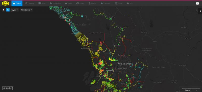
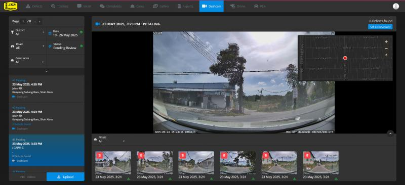
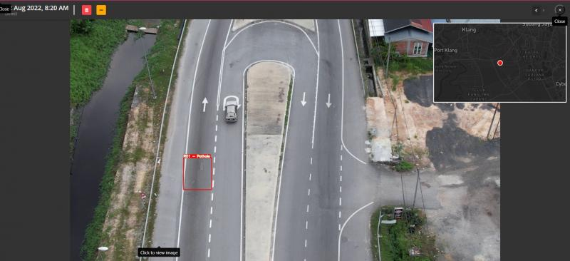
A Smart Road Asset Management System is a technology-driven solution designed to monitor, maintain, and manage road infrastructure efficiently. It combines IoT sensors, GIS mapping, drones, AI, and data analytics to provide real-time insights into the condition and usage of road assets such as pavements, signs, guardrails, bridges, and lighting systems. The system collects data using dashcam and drone video footage. Dashcams is installed in moving vehicles continuously capture high-resolution road surface videos, while drones conduct aerial inspections, offering a wider and more flexible view of the network. The footage is uploaded to a central platform, where AI-based computer vision algorithms automatically analyze each frame to detect and classify damage such as potholes, cracks, and rutting.
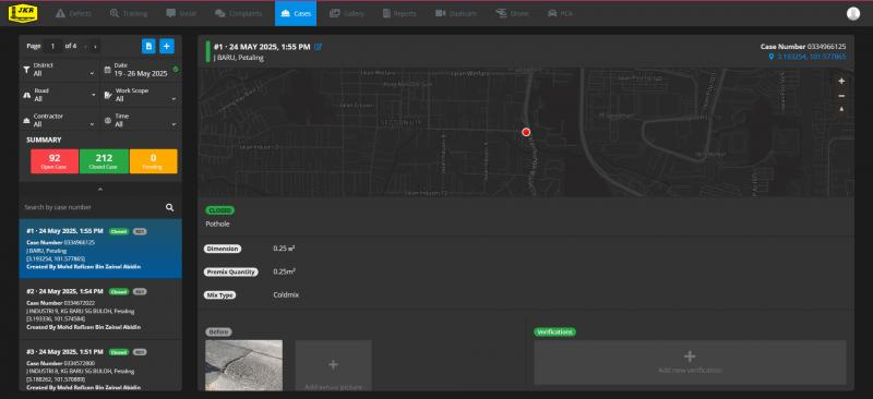
Additionally, each vehicle is equipped with a GPS tracker to track its real-time location and ensure proper route coverage during inspections. The system also integrates with social media platforms such as Twitter (now X), allowing citizens to submit complaints or posts about road damage, which can be linked directly into the asset management system. Based on all collected and processed data, SRAMS can automatically generate reports containing detailed information such as road names, dates of data collection, and types of road conditions. All findings are visualized on a centralized GIS dashboard, giving road authorities a live overview of asset conditions and helping prioritize maintenance tasks based on severity, location, and community feedback. This end-to-end automation reduces manual inspections, improves data accuracy, and enhances the efficiency of road maintenance operations.