Agriculture
MySTI Certified
STI202501545

Web and Mobile Geospatial Platform for Precision Oil Palm Plantation Management (GEO-PLANTATION)

MySpatial Sdn Bhd

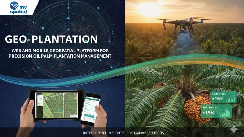
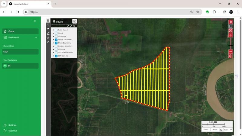
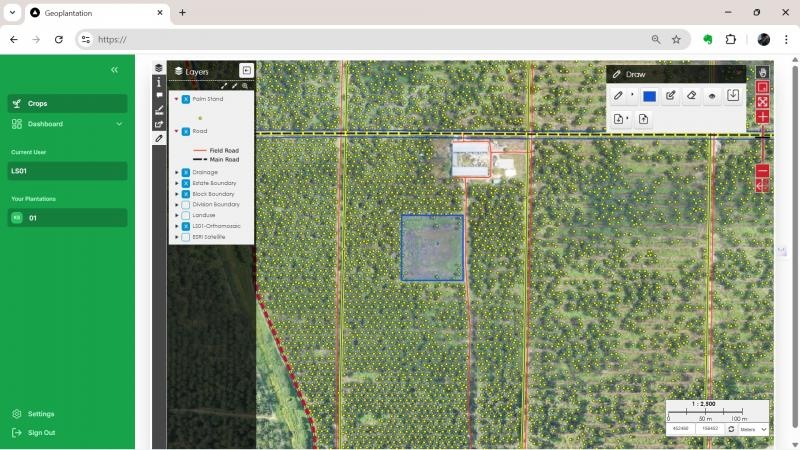
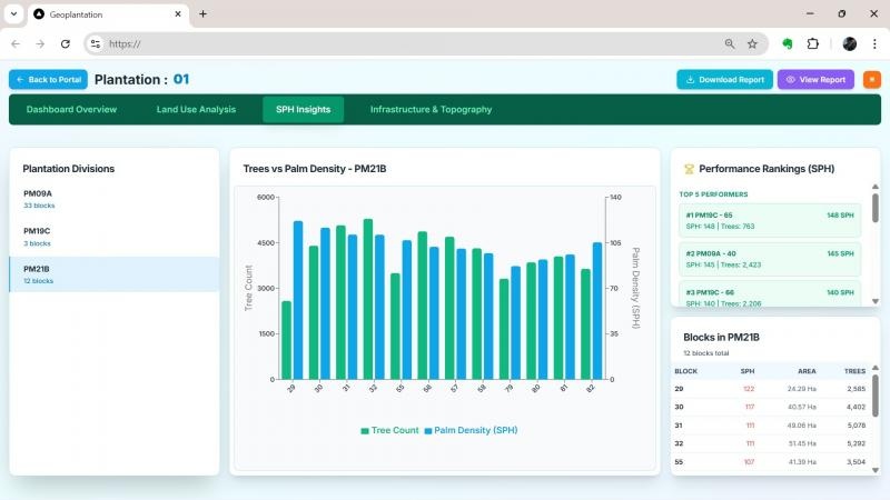
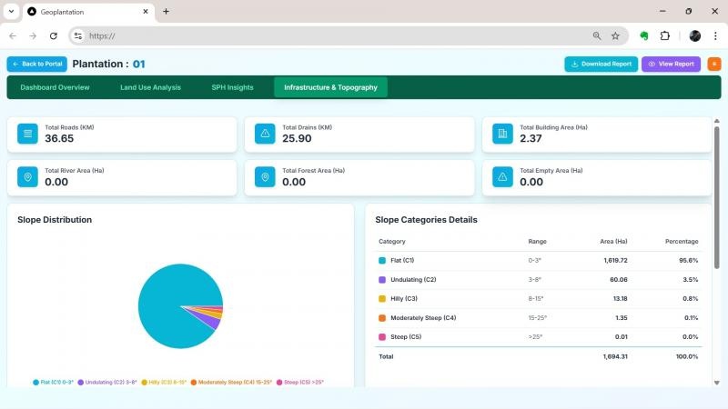
GeoPlantation is a cutting-edge web and mobile Geospatial platform designed to revolutionize oil palm plantation management through digital transformation, it integrates high-precision data from drones, satellites, and IoT sensors to create a dynamic digital twin of the plantation. Its core strength lies in translating complex data into actionable intelligence through powerful features, including AI-powered analytics for automated tree counting, landuse, road feature extraction and yield forecasting, real-time dashboards for plantation inventory and crop health monitoring , geospatial mapping for boundary and infrastructure management , and modules for scouting, advisory services, and marketplace integration. The platform benefits smallholders, medium-to-large plantation companies (B2B), and government agencies (B2G) by enhancing productivity, enabling data-driven decisions, ensuring traceability for sustainability compliance, and reducing operational costs through optimized resource allocation and early issue detection.

SSM Registration Number
MySpatial Sdn Bhd
ePerolehan Number
eP-1006I01N8
Indicative Price
MYR 5.00
Company Email Address
dini@myspatial.com.my
No items found.

Recommended Market Segment

Use Cases

Unique Selling Proposition

star

Purpose-Built for Oil Palm

Unlike generic GIS platforms, GeoPlantation is exclusively designed for oil palm plantations—integrating tree census, block boundaries, landuse analysis, palm density, road density, stand per hectare, and yield forecasting into one solution.

star

AI-Powered Precision Mapping with Drone/Satellite Integration for Unmatched Inventory Accuracy

GeoPlantation stands out by fusing high-resolution drone and satellite imagery with AI algorithms to automate oil palm tree counting, landuse analysis, and block boundary delineation, achieving 95%+ accuracy in inventory mapping—far superior to manual surveys.

star

Scalable, Secure, and Locally Integrated Architecture

Built on a modern, serverless cloud infrastructure, GeoPlantation is designed for massive scalability and high availability (99.9% uptime). Its modular architecture ensures it can adapt to future needs and easily connect with third-party systems. We provide enterprise-grade security with end-to-end encryption and OAuth2, while ensuring compliance with Malaysian data protection standards

star

ESG & Sustainability by Design

The platform directly supports Environmental, Social, and Governance (ESG) compliance by: 1. Monitoring land use and water resources. 2. Reducing fertilizer/pesticide waste. 3. Enabling transparent reporting to regulators and stakeholders.

star

High Accuracy, Low Cost

By using Drone or satellite imagery (10–30 cm resolution), GeoPlantation delivers highly accurate plantation inventories at a fraction of the cost of traditional surveys.

star